
Uttar Pradesh • उत्तर प्रदेश
हिन्दी (Hindi) & EnglishUP Bhulekh & UP Bhu Naksha
यूपी भूलेख और भू-नक्शा (UP Bhulekh & Bhu Naksha)
ROR: Khatauni (Adhikar Abhilekh)
Plot ID: Khasra / Gata Number
अखिल भारतीय डिजिटल भूमि अभिलेख एवं कैडस्ट्रल भू-नक्शा नागरिक सूचना प्रणाली • Official clearinghouse connecting citizens directly to verified National Informatics Centre (NIC) and State Government revenue servers (.gov.in and .nic.in) across all 36 States & Union Territories.
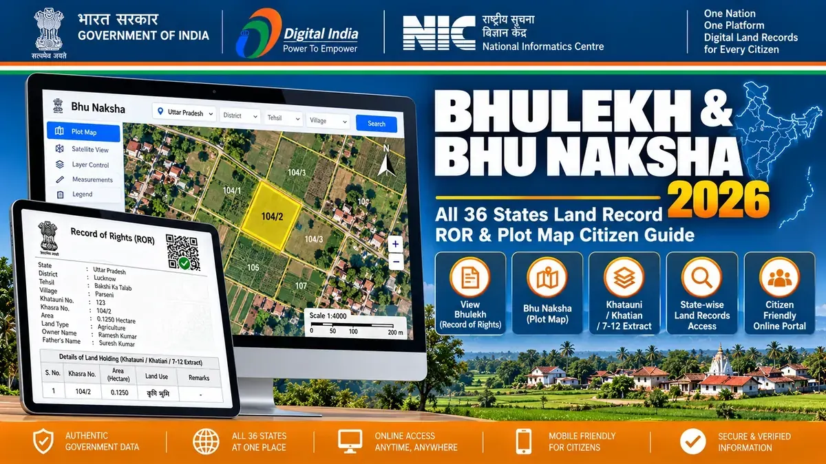
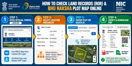
भारत में किसी भी राज्य का भूलेख (Record of Rights) अथवा भू-नक्शा (Cadastral Map) ऑनलाइन देखने के लिए संबंधित राज्य के अधिकृत NIC राजस्व पोर्टल पर जाएं। अपने जिले, तहसील एवं ग्राम का चयन करके खसरा अथवा खाता संख्या दर्ज करें। स्क्रीन पर भू-स्वामी का नाम, रकबा, श्रेणी एवं नक्शा रिपोर्ट तुरंत निःशुल्क उपलब्ध हो जाती है।
| National Jurisdiction | Republic of India (All 36 States & Union Territories) |
|---|---|
| Central Modernization Authority | Department of Land Resources (DoLR), Ministry of Rural Development |
| National DILRMP Portal | https://dolr.gov.in • https://dilrmp.gov.in |
| DILRMP Digitization Status | 95%+ Computerized Cadastral Records & Geo-Referenced Village Maps |
| National Land ID Metric | 14-Digit Unique Land Parcel Identification Number (ULPIN / Bhu-Aadhaar) |
| Citizen Public Access Fee | 100% Free Public Viewing; Official Certified Copies at Statutory State Fees |
| Evidentiary Admissibility | Section 35 & 74 Indian Evidence Act 1872 (Section 63 BSA 2023) |
| Citizen Grievance Support | Central CPGRAMS Portal (pgportal.gov.in) & Respective State CM Helplines |
Direct official NIC links to check Khatauni, Jamabandi, Satbara 7/12, Patta, or download cadastral plot maps across all 36 States.
Convert computerized hectares into regional Bigha, Biswa, Cent, Guntha, Gaj, Dismil, calculate map scale, or split family khata shares.
Inspect GIS village boundaries, Khasra plot geometry, and verify 1:4000 scale survey sheets before purchase or registry.
Verify the 5 mandatory government documents before giving token money: ROR, Naksha, 30-year EC, mutation order, and tax receipt.
.gov.in and .nic.in government servers. Never enter personal passwords or pay fees on unofficial third-party websites.
No need to struggle with complex state conversion formulas or manual land measurements. Calculate plot areas, divide co-sharer shares, estimate stamp duty, and convert units right here on this page:
Use these tools to calculate plot areas, divide co-sharer shares, estimate stamp duty, and verify records for Official State Revenue Portals:
Enter your plot area from Official State Revenue Portals to convert it across standard and regional measurement units. Click any result to copy.
Enter the North, South, East, and West boundary lengths of your plot from the Bhu Naksha (Mouza Map / FMB / Tippan) to calculate exact area.
Enter the property market or circle rate value to estimate stamp duty, female buyer concession savings, and registration fees.
Measure any plot side on your printed Bhu Naksha (Mouza Map / FMB / Tippan) with a ruler and convert that paper length into actual ground distance in Feet, Meters, and Kadi.
Choose the land revenue service you want to apply for to view the required documents, fee, and approval timeline.
Check off each verified item below while reviewing the seller's ROR (Khatauni / Khatian / 7-12 / Patta) and Bhu Naksha (Mouza Map / FMB / Tippan) before property registration.
Direct links to deep-dive state converters and specialized measurement pages:
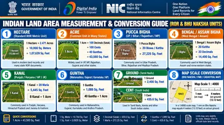
Converts Pucca and Kachha Bigha into square feet, square meters, acres, and hectares across UP (27,225 sq ft), Bihar, West Bengal, MP, and Rajasthan.
Two-way conversion between standard statutory acres (43,560 sq ft) and regional agricultural Bigha benchmarks across North and East India.
Decode computer-generated Khatauni records. Convert 4-decimal metric hectares (e.g. 0.4250 Ha) into local Bighas, Biswas, and Square Feet instantly.
Calculates regional plot measurements in Tamil Nadu, Andhra, Telangana, Kerala, Karnataka (Cent = 435.6 sq ft) and Maharashtra, Gujarat (Guntha = 1,089 sq ft).
Calculates exact individual land fractions (e.g. 1/3, 2/5, 3/8) from total joint ancestral holding to prevent inheritance and partition disputes.
Measures real ground distance in meters, feet, and Gunter chains from printed or on-screen 1:4000 village cadastral sheets and Tippan maps.
Compute exact square footage and square yards for non-rectangular fields and residential plots using 4 boundary sides and diagonal lengths.
Includes Gaj to Sq Ft, Dismil to Sq Ft, Stamp Duty Estimator, Land Valuation Rate Calculator, and Universal Unit Converter.
Search any local land term or state to get the exact button path and avoid portal errors:
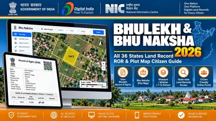
Bhulekh is the digital state land ownership register (Record of Rights or ROR), including West Bengal বাংলারভূমি খতিয়ান (Khatian), UP खतौनी (Khatauni), Bihar खतियान (Khatiyan), Maharashtra ७/१२ सातबारा (Satbara), Karnataka ಪಹಣಿ (RTC), and Tamil Nadu பட்டா சிட்டா (Patta). Bhu Naksha is the cadastral village plot map (মৌজা ম্যাপ, भू-नक्शा, FMB, or Tippan). Select your state below to view the guide in your state's local language and English.
Official state revenue servers (.gov.in and .nic.in) are the legal source for official records, but citizens frequently encounter session timeouts, non-mobile-friendly tables, and confusing revenue terms. BhulekhNaksha.org provides a fast, citizen-first clearinghouse that solves these common pain points:
Direct links to the exact query forms across all 36 states, bypassing broken landing pages, dead server links, and redirect loops.
Convert computerized Khatauni hectares directly into your state standard Bigha, Biswa, Katha, Cent, Guntha, and Square Feet instantly.
Step-by-step checklist to cross-verify ROR text names against cadastral village maps and 30-year Sub-Registrar encumbrance certificates.
Installable web application with high-contrast text and instant offline conversion tools designed for field use in tehsils and villages.
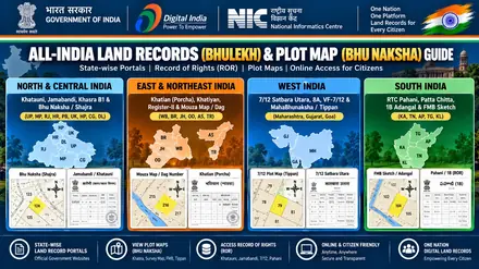
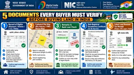
Direct official access to central land records, cadastral GIS mapping, property deed registration, and encumbrance verification:
View official land maps, village boundaries & cadastral plot geometry online.
Check land records, Khatauni, Jamabandi, and ownership details nationwide.
Central gateway for Digital India Land Records Modernization Programme (DILRMP).
Official Department of Land Resources (DoLR), Ministry of Rural Development, Govt of India.
Register sale deeds, gift deeds, mortgage deeds & verify circle rates.
Pay municipal and state property tax online across Indian cities (BharatKosh).
Verify if a property is free from legal dues, mortgages, or court attachments via DigiLocker.
Check registered real estate projects, promoter approvals, and verified agents nationwide.
The official Government of India Department of Land Resources (DoLR) maintains a national directory covering all 36 States and Union Territories. We use this central directory as our primary baseline because it officially identifies when a public Record of Rights (ROR) or Bhu Naksha portal is available, and when land administration relies on offline or customary systems.
Central Department of Land Resources directory of verified citizen starting points and state portal gaps.
National Generic Document Registration System linking participating states for online sale deed registration.
Department of Land Resources national cadastral mapping programme (naksha.dolr.gov.in) for GIS parcel verification.
Several states maintain dedicated GIS map portals separate from their text land record systems. Here are direct citizen access links:
The links below are citizen-facing starting points. Where the central directory lists no standalone public portal, we mark that clearly rather than guessing an unverified link.
| # | State | Official Land Records Portal | Status on DILRMP Directory | Ground Reality & Researcher Notes |
|---|---|---|---|---|
| 1 | Andhra Pradesh | MeeBhoomi (meebhoomi.ap.gov.in) | Active Public RoR | Provides online 1-B (ROR), Adangal, and separate FMB Bhu Naksha portal. |
| 2 | Arunachal Pradesh | Official State Portal (arunachalpradesh.gov.in) | Dedicated RoR Not Listed | Land holdings are governed by community customary tenure. Land Possession Certificates (LPC) are issued by District Administration. |
| 3 | Assam | Dharitree / Revenue Dept (ilrms.nic.in) | Active Public RoR | Accessible via ILRMS and Sewa Setu for Jamabandi and Dag number details. |
| 4 | Bihar | Bihar Bhumi (biharbhumi.bihar.gov.in) | Active Public RoR | Jamabandi Register-II, online Khatiyan, and separate Bhu Naksha cadastral sheets. |
| 5 | Chhattisgarh | CG Bhuiyan (bhuiyan.cg.nic.in) | Active Public RoR | Khasra (P-II), Khatauni (B-1), and digital plot maps online. |
| 6 | Goa | Settlement & Land Records (dslr.goa.gov.in) | Active Public RoR | Form I & XIV Record of Rights and cadastral survey plans. |
| 7 | Gujarat | AnyRoR (anyror.gujarat.gov.in) | Active Public RoR | Rural and urban VF-7/12 Satbara, VF-8A, and E-Dhara land records. |
| 8 | Haryana | Jamabandi (jamabandi.nic.in) | Active Public RoR | HALRIS Jamabandi Nakal, cadastral maps, and mutation tracking. |
| 9 | Himachal Pradesh | Himbhoomi (himachal.nic.in) | Active Public RoR | Land Records Computerization (LRC) Jamabandi and village Shajra maps. |
| 10 | Jharkhand | Jharbhoomi (jharbhoomi.jharkhand.gov.in) | Active Public RoR | Online Khatian, Register-II, and Dakhil-Kharij mutation portal. |
| 11 | Karnataka | Bhoomi (landrecords.karnataka.gov.in) | Active Public RoR | Pahani (RTC), mutation extract, and Dishaank GPS cadastral app. |
| 12 | Kerala | E-Rekha (erekha.kerala.gov.in) | Active Public RoR | Survey maps, settlement registers, and Thandaper account verification. |
| 13 | Madhya Pradesh | MP Bhulekh (mpbhulekh.gov.in) | Active Public RoR | WebGIS Khasra (P-II), Khatauni (B-1), and certified digital copies. |
| 14 | Maharashtra | Mahabhumi (mahabhumi.gov.in) | Active Public RoR | Mahabhulekh 7/12 Satbara, 8A, Ferfar, and MahaBhunaksha map sheets. |
| 15 | Manipur | LouchaPathap (louchapathap.nic.in) | Active Public RoR | Jamabandi / Patta land records for valley revenue districts. |
| 16 | Meghalaya | Meghalaya Government (meghalaya.gov.in) | Dedicated RoR Not Listed | Land administration is managed under Sixth Schedule Autonomous District Councils (KHADC, JHADC, GHADC). |
| 17 | Mizoram | Mizoram Government (mizoram.gov.in) | Dedicated RoR Not Listed | Land Settlement Certificates (LSC) managed via Directorate of Land Revenue & Settlement; standalone online RoR not listed on DILRMP directory. |
| 18 | Nagaland | Nagaland Government (nagaland.gov.in) | Dedicated RoR Not Listed | Article 371A protects traditional customary land ownership. Village Councils and DC offices manage records without a digital RoR portal. |
| 19 | Odisha | Bhulekh Odisha (bhulekh.ori.nic.in) | Active Public RoR | Khatiyan (ROR), Tenant records, and Bhu Naksha Odisha map sheets. |
| 20 | Punjab | Punjab Land Records (jamabandi.punjab.gov.in) | Active Public RoR | PLRS Jamabandi Nakal, Fard, mutation order details, and Roznamcha. |
| 21 | Rajasthan | Apna Khata (apnakhata.rajasthan.gov.in) | Active Public RoR | E-Dharti Jamabandi Nakal, Khasra information, and village Bhu Naksha. |
| 22 | Sikkim | Sikkim Government (sikkim.gov.in) | Dedicated RoR Not Listed | Parcha (Khatiyan) records maintained by Land Revenue & Disaster Management Department (LRDMD). Standalone public portal not listed on DILRMP. |
| 23 | Tamil Nadu | Tamil Nadu e-Services (eservices.tn.gov.in) | Active Public RoR | Tamil Nilam Patta, Chitta, A-Register extract, and FMB sketches. |
| 24 | Telangana | Bhu Bharati (bhubharati.telangana.gov.in) | Active Public RoR | Integrated land records platform (formerly Dharani) for Pahani and ROR-1B. |
| 25 | Tripura | Jami Tripura (jami.tripura.gov.in) | Active Public RoR | Online Khatian (ROR) and cadastral plot maps across sub-divisions. |
| 26 | Uttar Pradesh | UP Bhulekh (upbhulekh.gov.in) | Active Public RoR | Real-time Khatauni, 16-digit Gata code, and UP Bhu Naksha Shajra maps. |
| 27 | Uttarakhand | Uttarakhand Bhulekh (bhulekh.uk.gov.in) | Active Public RoR | Devbhoomi portal for Khatauni and cadastral village maps. |
| 28 | West Bengal | Banglarbhumi (banglarbhumi.gov.in) | Active Public RoR | Khatian and Plot Information, Mouza maps, and online mutation applications. |
| # | Union Territory | Official Portal Link | Status on DILRMP Directory | Administrative Ground Notes |
|---|---|---|---|---|
| 1 | Andaman & Nicobar Islands | Dweep Bhoomi (dweepbhoomi.andamannicobar.gov.in) | Active Public RoR | Form-F / Khatiyan land records online. |
| 2 | Chandigarh | Chandigarh Revenue (revenue.chd.gov.in) | Active Public Portal | Estate office records and Jamabandi details. |
| 3 | Dadra & Nagar Haveli and Daman & Diu | UT Administration (ddd.gov.in) | Dedicated RoR URL Not Verified | Form I & XIV (Daman/Diu) and 7/12 (DNH) managed via Collectorate Revenue Offices. |
| 4 | Delhi (NCT) | Delhi Land Records (dlrc.delhigovt.nic.in) | Active Public RoR | Indraprastha Bhulekh, Khatauni, and Jamabandi records. |
| 5 | Jammu and Kashmir | J&K Revenue Dept (jkrevenue.nic.in) | Direct Citizen RoR URL Not Verified | Aapki Zameen Aapki Nigrani initiative; public search availability varies by revenue district. |
| 6 | Ladakh | Ladakh Administration (ladakh.gov.in) | Dedicated RoR Portal Not Verified | Revenue records maintained locally by Deputy Commissioner offices in Leh and Kargil. |
| 7 | Lakshadweep | Lakshadweep Admin (lakshadweep.gov.in) | Departmental Administration | Island land register records managed via local revenue and settlement branch. |
| 8 | Puducherry | Nilamagal Portal (pon.nic.in/nilamagal) | Active Public RoR | Nilamagal land-records service for Patta copy and settlement register extract. |
Known limitation: We have not guessed an unverified direct login URL for any state. Some portals provide public records without login, and some states (especially Sixth Schedule tribal regions in the North-East) do not have a separately listed online RoR or cadastral map service because land rights are governed by traditional customary laws and Village Councils. The central Department of Land Resources (DILRMP) directory is the most reliable baseline for verifying those differences.
भूलेख नक्शा एक online platform है जो उपयोगकर्ताओं को भारत के विभिन्न राज्यों के भूमि records, plot map और संपत्ति से संबंधित information देखने में मदद करता है। भूमि records के डिजिटलीकरण (DILRMP) के कारण अब khasra number, khata details, ownership records और जमीन का नक्शा घर बैठे आसानी से देखा जा सकता है।
सरकारी offices के बार-बार चक्कर लगाने के बजाय, आप इस website के माध्यम से उन official portals तक पहुँच सकते हैं जहाँ से आप भूलेख नक्शा और भूमि records online जल्दी और आसानी से देख सकते हैं। यह platform राज्य सरकारों की भूमि record websites के links और स्पष्ट information प्रदान करता है ताकि उपयोगकर्ता बिना किसी भ्रम के सही जानकारी प्राप्त कर सकें।
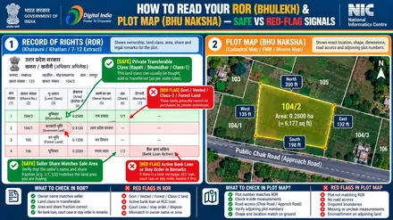
भूलेख नक्शा, जिसे भू नक्शा (Bhu Naksha) भी कहा जाता है, किसी जमीन या संपत्ति का digital map होता है जिसमें जमीन की सीमाएँ, plot number और भूमि का geographical layout दिखाया जाता है। यह भारत के कई राज्य सरकारों द्वारा शुरू की गई digital land record system का हिस्सा है, जिसका उद्देश्य भूमि record management को आसान बनाना और transparency बढ़ाना है।
यह website भूमि से संबंधित कई online services तक पहुँचने के लिए information और guidance प्रदान करती है। प्रमुख सेवाएँ इस प्रकार हैं:
अपनी जमीन का नक्शा या संपत्ति विवरण online देखना बहुत आसान है। नीचे दिए गए चरणों का पालन करें:
भारत के सभी 28 राज्यों और 8 केंद्र शासित प्रदेशों ने अपने भूमि record system को digital बना दिया है। प्रमुख राज्यों के सीधे लिंक्स:
भूलेख नक्शा उपयोगकर्ताओं को विभिन्न government portals तक आसानी से पहुँचने में मदद करता है जहाँ भूमि records उपलब्ध होते हैं। यह website एक informational guide के रूप में काम करती है जो भूमि नक्शा, khasra records और संपत्ति ownership details online ढूँढने की प्रक्रिया को सरल बनाती है। चाहे आप अपनी जमीन की information verify करना चाहते हों, जमीन खरीदने से पहले plot check करना चाहते हों, या अपनी संपत्ति की सीमाओं को समझना चाहते हों, यह platform भूमि record information प्राप्त करने का एक प्रामाणिक माध्यम प्रदान करता है।
Each state page provides complete guides and interactive map banners in English and the state's official regional language.
यूपी भूलेख और भू-नक्शा (UP Bhulekh & Bhu Naksha)
ROR: Khatauni (Adhikar Abhilekh)
Plot ID: Khasra / Gata Number
एमपी भूलेख (MP Bhulekh WebGIS 2.0)
ROR: Khasra (P-II) & Khatauni (B-1)
Plot ID: Khasra Number
अपना खाता (Apna Khata) और राजस्थान भू-नक्शा
ROR: Jamabandi (Nakal)
Plot ID: Khasra Number
जमाबंदी हरियाणा (Jamabandi Haryana)
ROR: Jamabandi Nakal
Plot ID: Khasra / Killa & Murabba Number
ਪੰਜਾਬ ਲੈਂਡ ਰਿਕਾਰਡ ਸੋਸਾਇਟੀ (PLRS Jamabandi)
ROR: Jamabandi (Fard)
Plot ID: Khasra / Killa Number
हिमभूमि (HimBhoomi - अपना खाता हिमाचल)
ROR: Jamabandi
Plot ID: Khasra Number
देवभूमि भूलेख उत्तराखंड (Devbhoomi Bhulekh)
ROR: Khatauni (RoR)
Plot ID: Khasra / Gata Number
सीजी भुइयां और भू-नक्शा (CG Bhuiyan)
ROR: Khasra (P-II) & Khatauni (B-1)
Plot ID: Khasra Number
दिल्ली भूलेख (DLRC / इंद्रप्रस्थ भूलेख)
ROR: Khatauni / Jamabandi
Plot ID: Khasra / Mustatil & Killa Number
आपकी ज़मीन आपकी निगरानी (Aapki Zameen Aapki Nigrani)
ROR: Jamabandi
Plot ID: Khasra / Survey Number
लद्दाख राजस्व पोर्टल (Ladakh Revenue Portal)
ROR: Jamabandi
Plot ID: Khasra Number
ਚੰਡੀਗੜ੍ਹ ਰੈਵੇਨਿਊ ਪੋਰਟਲ (Chandigarh Revenue Portal)
ROR: Jamabandi
Plot ID: Khasra / Sector Plot Number
बिहार भूमि और बिहार भू-नक्शा (Bihar Bhumi & Bhu Naksha)
ROR: Khatiyan / Jamabandi Register-II
Plot ID: Khesra (Plot) Number
झारभूमि (Jharbhoomi Jharkhand)
ROR: Khatian & Register-II
Plot ID: Khesra / Plot Number
বাংলারভূমি (Banglarbhumi West Bengal)
ROR: Khatian (Porcha / ROR)
Plot ID: Dag Number (LR / RS Plot)
ଭୂଲେଖ ଓଡ଼ିଶା ଏବଂ ଭୂ-ନକ୍ସା (Bhulekh Odisha & BhuNaksha)
ROR: Khatiyan (ROR / Patta)
Plot ID: Plot Number
ধৰিত্ৰী অসম (ILRMS Dharitree & Sewa Setu)
ROR: Jamabandi (Patta)
Plot ID: Dag Number
জমি ত্রিপুরা (Jami Tripura)
ROR: Khatian (ROR)
Plot ID: Sabek / Hal Plot (Dag) Number
লৌচা পথাপ (Loucha Pathap Manipur)
ROR: Jamabandi / Patta
Plot ID: Dag Number (CS / New Dag)
Meghalaya Revenue & Autonomous District Council Land Records
ROR: Land Holding Certificate / Patta
Plot ID: Plot / Dag Number
Mizoram Land Revenue & Settlement (LSC Portal)
ROR: Land Settlement Certificate (LSC) / Patta
Plot ID: LSC / Plot Number
Nagaland Directorate of Land Records & Survey
ROR: Patta / Jamabandi
Plot ID: Plot / Dag Number
अरुणाचल लैंड मैनेजमेंट पोर्टल (Arunachal LPC Portal)
ROR: Land Possession Certificate (LPC) / Allotment Order
Plot ID: Plot / Passbook Number
सिक्किम भूमि अभिलेख (Sikkim Land Records - Parcha)
ROR: Parcha (Khatiyan)
Plot ID: Khasra / Plot Number
महाभूलेख (७/१२ सातबारा, ८अ) आणि महाभू-नकाशा
ROR: 7/12 Extract (Satbara Utara) & 8A
Plot ID: Gat Number / Survey Number (CTS Number in Urban Areas)
એનીઆરઓઆર ગુજરાત (AnyROR Gujarat & iORA)
ROR: VF-7/12 (Satbara) & VF-8A
Plot ID: Survey Number / Block Number
DSLRS गोवा (Form I & XIV आणि सर्वे प्लॅन)
ROR: Form I & XIV (Record of Rights)
Plot ID: Survey Number & Sub-Division Number (or Chalta/PT Sheet in Cities)
અવની / UT Revenue Portal (DNH & DD)
ROR: Form I & XIV (Daman/Diu) & 7/12 Extract (DNH)
Plot ID: Survey Number / Gut Number
ಭೂಮಿ ಪೋರ್ಟಲ್ ಮತ್ತು ದಿಶಾಂಕ್ (Bhoomi RTC & Dishaank Map)
ROR: RTC (Record of Rights, Tenancy and Crops) / Pahani
Plot ID: Survey Number & Hissa Number
భూ భారతి తెలంగాణ (Bhu Bharati Telangana)
ROR: Pahani & ROR-1B
Plot ID: Survey Number & Sub-Division
మీభూమి ఆంధ్రప్రదేశ్ (Meebhoomi AP)
ROR: Adangal (Village / Personal) & 1-B (ROR)
Plot ID: Survey Number / LP Number (Land Parcel)
தமிழ் நிலம் (Tamil Nilam: TN E-Services)
ROR: Patta & Chitta / A-Register
Plot ID: Survey Number & Sub-Division Number (or TSLR Ward/Block in Towns)
ഇ-രേഖ & റവന്യൂ ഇ-സർവീസസ് (E-Rekha & Kerala Revenue)
ROR: Thandaper Account & Patta (Pattayam)
Plot ID: Resurvey Number & Block Number (or Old Survey Number)
நிலம் டைரக்ட் (Nilamagal Puducherry)
ROR: Patta Copy & Settlement Register Extract
Plot ID: R.S. Number (Re-Survey) / Cadastre Number (Old Survey)
द्वीप भूमि (Dweep Bhoomi A&N Islands)
ROR: Record of Rights (Form-B / Khatiyan)
Plot ID: Survey Number
ലക്ഷദ്വീപ് റവന്യൂ പോർട്ടൽ (Lakshadweep Revenue Records)
ROR: Record of Rights (Land Register)
Plot ID: Survey Number & Sub-Division
Direct one-click links to each state's Ownership Register (ROR), Cadastral Plot Map (Bhu Naksha), Citizen OTP Login (Mutation & Signed Copy), and Sub-Registrar Encumbrance Certificate (EC) portal:
| State / UT | 1. ROR / Khata Portal | 2. Plot Map (Naksha) Portal | 3. Citizen Login & Mutation | 4. Sub-Registrar EC & Stamp | State Guide |
|---|---|---|---|---|---|
|
Uttar Pradesh (UP) उत्तर प्रदेश |
Uttar Pradesh Khatauni ↗ Khatauni (upbhulekh.gov.in) |
Uttar Pradesh UP Bhu Naksha / Shajra ↗ UP Bhu Naksha / Shajra (upbhunaksha.gov.in) |
Uttar Pradesh Citizen Login ↗ Verify Co-sharer Fractional Shares |
Uttar Pradesh IGRS ↗ Deed / EC (igrsup.gov.in) |
Full Guide → |
|
Madhya Pradesh (MP) मध्य प्रदेश |
Madhya Pradesh Khasra ↗ Khasra (webgis2.mpbhulekh.gov.in) |
Madhya Pradesh Bhu-Naksha / Bhulekh WebGIS Map ↗ Bhu-Naksha / Bhulekh WebGIS Map (webgis2.mpbhulekh.gov.in) |
Madhya Pradesh Citizen Login ↗ Public User Login on mpbhulekh.gov.in |
Madhya Pradesh IGRS ↗ Deed / EC (mpigr.gov.in) |
Full Guide → |
|
Rajasthan (RJ) राजस्थान |
Rajasthan Jamabandi ↗ Jamabandi (apnakhata.rajasthan.gov.in) |
Rajasthan Bhu Naksha ↗ Rajasthan Bhu Naksha (bhunaksha.rajasthan.gov.in) |
Rajasthan Citizen Login ↗ Rajasthan SSO ID + Password / Jan Aadhaar OTP |
Rajasthan IGRS ↗ Deed / EC (epanjiyan.rajasthan.gov.in) |
Full Guide → |
|
Haryana (HR) हरियाणा |
Haryana Jamabandi Nakal ↗ Jamabandi Nakal (jamabandi.nic.in) |
Haryana Shajra / Cadastral Map ↗ Shajra / Cadastral Map (jamabandi.nic.in) |
Haryana Citizen Login ↗ Citizen Login |
Haryana IGRS ↗ Deed / EC (jamabandi.nic.in) |
Full Guide → |
|
Punjab (PB) ਪੰਜਾਬ |
Punjab Jamabandi ↗ Jamabandi (jamabandi.punjab.gov.in) |
Punjab Musavi / Cadastral Shajra ↗ Musavi / Cadastral Shajra (jamabandi.punjab.gov.in) |
Punjab Citizen Login ↗ Mobile OTP Login |
Punjab IGRS ↗ Deed / EC (igrpunjab.gov.in) |
Full Guide → |
|
Himachal Pradesh (HP) हिमाचल प्रदेश |
Himachal Pradesh Jamabandi ↗ Jamabandi (himseva.hp.gov.in) |
Himachal Pradesh Musavi / Latha ↗ Musavi / Latha (himseva.hp.gov.in) |
Himachal Pradesh Citizen Login ↗ HimSeva Citizen Login |
Himachal Pradesh IGRS ↗ Deed / EC (ngdrs.gov.in) |
Full Guide → |
|
Uttarakhand (UK) उत्तराखंड |
Uttarakhand Khatauni ↗ Khatauni (bhulekh.uk.gov.in) |
Uttarakhand Devbhoomi Bhu Naksha ↗ Devbhoomi Bhu Naksha (bhunaksha.uk.gov.in) |
Uttarakhand Citizen Login ↗ Apuni Sarkar Citizen Mobile OTP Login |
Uttarakhand IGRS ↗ Deed / EC (registration.uk.gov.in) |
Full Guide → |
|
Chhattisgarh (CG) छत्तीसगढ़ |
Chhattisgarh Khasra ↗ Khasra (bhuiyan.cg.nic.in) |
Chhattisgarh CG Bhu Naksha ↗ CG Bhu Naksha (bhunaksha.cg.nic.in) |
Chhattisgarh Citizen Login ↗ Citizen Mobile OTP Login |
Chhattisgarh IGRS ↗ Deed / EC (epanjeeyan.cg.gov.in) |
Full Guide → |
|
Delhi (NCT) (DL) दिल्ली |
Delhi (NCT) Khatauni / Jamabandi ↗ Khatauni / Jamabandi (dlrc.delhigovt.nic.in) |
Delhi (NCT) Delhi Revenue Cadastral Map ↗ Delhi Revenue Cadastral Map (revenue.delhi.gov.in) |
Delhi (NCT) Citizen Login ↗ e-District Citizen ID + Mobile OTP |
Delhi (NCT) IGRS ↗ Deed / EC (doris.delhigovt.nic.in) |
Full Guide → |
|
Jammu & Kashmir (JK) जम्मू और कश्मीर |
Jammu & Kashmir Jamabandi ↗ Jamabandi (landrecords.jk.gov.in) |
Jammu & Kashmir Masavi / Latha Map ↗ Masavi / Latha Map (eunnat.jk.gov.in) |
Jammu & Kashmir Citizen Login ↗ Citizen Mobile OTP Login on landrecords.jk.gov.in |
Jammu & Kashmir IGRS ↗ Deed / EC (eunnat.jk.gov.in) |
Full Guide → |
|
Ladakh (LA) लद्दाख |
Ladakh Jamabandi ↗ Jamabandi (ladakh.gov.in) |
Ladakh Cadastral Masavi Map ↗ Cadastral Masavi Map (dilrmp.gov.in) |
Ladakh Citizen Login ↗ Citizen Mobile OTP Login on ladakh.Choices.gov.in |
Ladakh IGRS ↗ Deed / EC (dilrmp.gov.in) |
Full Guide → |
|
Chandigarh (CH) ਚੰਡੀਗੜ੍ਹ |
Chandigarh Jamabandi ↗ Jamabandi (revenue.chd.gov.in) |
Chandigarh Village Shajra / Estate Sector Map ↗ Village Shajra / Estate Sector Map (estateoffice.chd.gov.in) |
Chandigarh Citizen Login ↗ Citizen Mobile OTP Login on chdrevenue.gov.in |
Chandigarh IGRS ↗ Deed / EC (estateoffice.chd.gov.in) |
Full Guide → |
|
Bihar (BR) बिहार |
Bihar Khatiyan / Jamabandi Register-II ↗ Khatiyan / Jamabandi Register-II (biharbhumi.bihar.gov.in) |
Bihar Bhu Naksha ↗ Bihar Bhu Naksha (bhunaksha.bihar.gov.in) |
Bihar Citizen Login ↗ Track Mutation Status |
Bihar IGRS ↗ Deed / EC (bhumijankari.bihar.gov.in) |
Full Guide → |
|
Jharkhand (JH) झारखंड |
Jharkhand Khatian & Register-II ↗ Khatian & Register-II (jharbhoomi.jharkhand.gov.in) |
Jharkhand Jharbhoomi Bhu Naksha ↗ Jharbhoomi Bhu Naksha (jharbhoomi.jharkhand.gov.in) |
Jharkhand Citizen Login ↗ Online Application / Lagan Login |
Jharkhand IGRS ↗ Deed / EC (regd.jharkhand.gov.in) |
Full Guide → |
|
West Bengal (WB) পশ্চিমবঙ্গ |
West Bengal Khatian ↗ Khatian (banglarbhumi.gov.in) |
West Bengal Digitized Mouza Map ↗ Digitized Mouza Map (banglarbhumi.gov.in) |
West Bengal Citizen Login ↗ Citizen Sign-In |
West Bengal IGRS ↗ Deed / EC (wbregistration.gov.in) |
Full Guide → |
|
Odisha (OD) ଓଡ଼ିଶା |
Odisha Khatiyan ↗ Khatiyan (bhulekh.ori.nic.in) |
Odisha BhuNaksha ↗ Odisha BhuNaksha (bhunakshaodisha.nic.in) |
Odisha Citizen Login ↗ Mobile OTP Login |
Odisha IGRS ↗ Deed / EC (igrodisha.gov.in) |
Full Guide → |
|
Assam (AS) অসম |
Assam Jamabandi ↗ Jamabandi (ilrms.assam.gov.in) |
Assam Bhu-Naksha / Village Trace Map ↗ Bhu-Naksha / Village Trace Map (ilrms.assam.gov.in) |
Assam Citizen Login ↗ Sewa Setu Citizen OTP / DigiLocker Login |
Assam IGRS ↗ Deed / EC (igr.assam.gov.in) |
Full Guide → |
|
Tripura (TR) ত্রিপুরা |
Tripura Khatian ↗ Khatian (jami.tripura.gov.in) |
Tripura Bhu-Naksha ↗ Tripura Bhu-Naksha (jami.tripura.gov.in) |
Tripura Citizen Login ↗ Citizen Mobile OTP Login |
Tripura IGRS ↗ Deed / EC (ngdrs.tripura.gov.in) |
Full Guide → |
|
Manipur (MN) মণিপুর |
Manipur Jamabandi / Patta ↗ Jamabandi / Patta (louchapathap.nic.in) |
Manipur Village Cadastral Dag Map ↗ Village Cadastral Dag Map (louchapathap.nic.in) |
Manipur Citizen Login ↗ Citizen Mobile OTP Login |
Manipur IGRS ↗ Deed / EC (ngdrs.gov.in) |
Full Guide → |
|
Meghalaya (ML) Ka Ri Khasi-Jaintia & A'chik |
Meghalaya Land Holding Certificate / Patta ↗ Land Holding Certificate / Patta (meghalaya.gov.in) |
Meghalaya Survey Plot Map ↗ Survey Plot Map (megrevenuedm.gov.in) |
Meghalaya Citizen Login ↗ Citizen Mobile OTP Login on megrevenuedm.gov.in |
Meghalaya IGRS ↗ Deed / EC (dilrmp.gov.in) |
Full Guide → |
|
Mizoram (MZ) Mizoram |
Mizoram Land Settlement Certificate ↗ Land Settlement Certificate (mizoram.gov.in) |
Mizoram LSC Cadastral Plan ↗ LSC Cadastral Plan (landrevenue.mizoram.gov.in) |
Mizoram Citizen Login ↗ Citizen Mobile OTP Login on landrevenue.mizoram.gov.in |
Mizoram IGRS ↗ Deed / EC (dilrmp.gov.in) |
Full Guide → |
|
Nagaland (NL) Nagaland |
Nagaland Patta / Jamabandi ↗ Patta / Jamabandi (nagaland.gov.in) |
Nagaland Cadastral Survey Trace Map ↗ Cadastral Survey Trace Map (dilrmp.gov.in) |
Nagaland Citizen Login ↗ Citizen Mobile OTP Login on dlrs.nagaland.gov.in |
Nagaland IGRS ↗ Deed / EC (dilrmp.gov.in) |
Full Guide → |
|
Arunachal Pradesh (AR) अरुणाचल प्रदेश |
Arunachal Pradesh Land Possession Certificate ↗ Land Possession Certificate (arunachalpradesh.gov.in) |
Arunachal Pradesh Sketch Map / Cadastral Allotment Map ↗ Sketch Map / Cadastral Allotment Map (dilrmp.gov.in) |
Arunachal Pradesh Citizen Login ↗ Citizen Mobile OTP Login on eservice.arunachal.gov.in |
Arunachal Pradesh IGRS ↗ Deed / EC (dilrmp.gov.in) |
Full Guide → |
|
Sikkim (SK) सिक्किम |
Sikkim Parcha ↗ Parcha (sikkim.gov.in) |
Sikkim Cadastral Block Map ↗ Cadastral Block Map (dilrmp.gov.in) |
Sikkim Citizen Login ↗ Citizen Mobile OTP Login on sikkimlrdm.gov.in |
Sikkim IGRS ↗ Deed / EC (dilrmp.gov.in) |
Full Guide → |
|
Maharashtra (MH) महाराष्ट्र |
Maharashtra 7/12 Extract ↗ 7/12 Extract (bhulekh.mahabhumi.gov.in) |
Maharashtra MahaBhunaksha ↗ MahaBhunaksha (mahabhunakasha.mahabhumi.gov.in) |
Maharashtra Citizen Login ↗ Public User ID + Password / Mobile OTP |
Maharashtra IGRS ↗ Deed / EC (igrmaharashtra.gov.in) |
Full Guide → |
|
Gujarat (GJ) ગુજરાત |
Gujarat VF-7/12 ↗ VF-7/12 (anyror.gujarat.gov.in) |
Gujarat Village Tippan / Resurvey Map ↗ Village Tippan / Resurvey Map (iora.gujarat.gov.in) |
Gujarat Citizen Login ↗ Citizen Mobile Number + OTP Login |
Gujarat IGRS ↗ Deed / EC (garvi.gujarat.gov.in) |
Full Guide → |
|
Goa (GA) गोंय / गोवा |
Goa Form I & XIV ↗ Form I & XIV (dslr.goa.gov.in) |
Goa Cadastral Survey Plan ↗ Cadastral Survey Plan (dslr.goa.gov.in) |
Goa Citizen Login ↗ Goa Online Citizen Login |
Goa IGRS ↗ Deed / EC (dslr.goa.gov.in) |
Full Guide → |
|
Dadra & Nagar Haveli and Daman & Diu (DD) દાદરા અને નગર હવેલી તથા દમણ અને દીવ |
Dadra & Nagar Haveli and Daman & Diu Form I & XIV ↗ Form I & XIV (ddd.gov.in) |
Dadra & Nagar Haveli and Daman & Diu Cadastral Survey Map / Tippan ↗ Cadastral Survey Map / Tippan (dilrmp.gov.in) |
Dadra & Nagar Haveli and Daman & Diu Citizen Login ↗ Citizen Mobile OTP Login on dnh.gov.in |
Dadra & Nagar Haveli and Daman & Diu IGRS ↗ Deed / EC (dilrmp.gov.in) |
Full Guide → |
|
Karnataka (KA) ಕರ್ನಾಟಕ |
Karnataka RTC ↗ RTC (landrecords.karnataka.gov.in) |
Karnataka Revenue Survey Map / Tippan / Akarband ↗ Revenue Survey Map / Tippan / Akarband (landrecords.karnataka.gov.in) |
Karnataka Citizen Login ↗ Citizen Mobile OTP Login |
Karnataka IGRS ↗ Deed / EC (kaveri.karnataka.gov.in) |
Full Guide → |
|
Telangana (TG) తెలంగాణ |
Telangana Pahani & ROR-1B ↗ Pahani & ROR-1B (bhubharati.telangana.gov.in) |
Telangana Cadastral Tippan / Village Revenue Map ↗ Cadastral Tippan / Village Revenue Map (bhubharati.telangana.gov.in) |
Telangana Citizen Login ↗ Citizen Sign-In |
Telangana IGRS ↗ Deed / EC (registration.telangana.gov.in) |
Full Guide → |
|
Andhra Pradesh (AP) ఆంధ్రప్రదేశ్ |
Andhra Pradesh Adangal ↗ Adangal (meebhoomi.ap.gov.in) |
Andhra Pradesh FMB ↗ FMB (meebhoomi.ap.gov.in) |
Andhra Pradesh Citizen Login ↗ Citizen Mobile OTP Login |
Andhra Pradesh IGRS ↗ Deed / EC (registration.ap.gov.in) |
Full Guide → |
|
Tamil Nadu (TN) தமிழ்நாடு |
Tamil Nadu Patta & Chitta / A-Register ↗ Patta & Chitta / A-Register (eservices.tn.gov.in) |
Tamil Nadu FMB ↗ FMB (eservices.tn.gov.in) |
Tamil Nadu Citizen Login ↗ Citizen Mobile OTP Login |
Tamil Nadu IGRS ↗ Deed / EC (tnreginet.gov.in) |
Full Guide → |
|
Kerala (KL) കേരളം |
Kerala Thandaper Account & Patta ↗ Thandaper Account & Patta (erekha.kerala.gov.in) |
Kerala FMB Sketch ↗ FMB Sketch (erekha.kerala.gov.in) |
Kerala Citizen Login ↗ Citizen Login |
Kerala IGRS ↗ Deed / EC (keralaregistration.gov.in) |
Full Guide → |
|
Puducherry (PY) புதுச்சேரி |
Puducherry Patta Copy & Settlement Register Extract ↗ Patta Copy & Settlement Register Extract (nilamagal.py.gov.in) |
Puducherry FMB ↗ FMB (edistrict.py.gov.in) |
Puducherry Citizen Login ↗ Citizen Mobile OTP Login on nilamagal.py.gov.in |
Puducherry IGRS ↗ Deed / EC (edistrict.py.gov.in) |
Full Guide → |
|
Andaman & Nicobar Islands (AN) अंडमान और निकोबार द्वीप समूह |
Andaman & Nicobar Islands Record of Rights ↗ Record of Rights (dweepbhoomi.andamannicobar.gov.in) |
Andaman & Nicobar Islands Cadastral Village / Holding Map ↗ Cadastral Village / Holding Map (dweepbhoomi.andamannicobar.gov.in) |
Andaman & Nicobar Islands Citizen Login ↗ Dweep Bhoomi Citizen Portal |
Andaman & Nicobar Islands IGRS ↗ Deed / EC (dweepbhoomi.andamannicobar.gov.in) |
Full Guide → |
|
Lakshadweep (LD) ലക്ഷദ്വീപ് |
Lakshadweep Record of Rights ↗ Record of Rights (lakshadweep.gov.in) |
Lakshadweep Island FMB / Cadastral Map ↗ Island FMB / Cadastral Map (edistrict.utl.gov.in) |
Lakshadweep Citizen Login ↗ Citizen Mobile OTP Login on lakshadweep.gov.in |
Lakshadweep IGRS ↗ Deed / EC (edistrict.utl.gov.in) |
Full Guide → |
Compare each state's native name, regional language, official portal, ROR document, and plot identifier:
| State / UT (English & Native) | Official Revenue Portal | ROR Document Name | Cadastral Map Name | Plot / Survey ID | Government Link |
|---|---|---|---|---|---|
| Uttar Pradesh (UP) • उत्तर प्रदेश हिन्दी (Hindi) |
UP Bhulekh & UP Bhu Nakshaupbhulekh.gov.in • यूपी भूलेख और भू-नक्शा (UP Bhulekh & Bhu Naksha) |
Khatauni (Adhikar Abhilekh) | UP Bhu Naksha / Shajra | Khasra / Gata Number | Visit UP Bhulekh & UP Bhu Naksha (upbhulekh.gov.in) ↗ |
| Madhya Pradesh (MP) • मध्य प्रदेश हिन्दी (Hindi) |
MP Bhulekh (WebGIS 2.0)webgis2.mpbhulekh.gov.in • एमपी भूलेख (MP Bhulekh WebGIS 2.0) |
Khasra (P-II) & Khatauni (B-1) | Bhu-Naksha / Bhulekh WebGIS Map | Khasra Number | Visit MP Bhulekh (webgis2.mpbhulekh.gov.in) ↗ |
| Rajasthan (RJ) • राजस्थान हिन्दी (Hindi) |
Apna Khata (E-Dharti) & Rajasthan Bhu Nakshaapnakhata.rajasthan.gov.in • अपना खाता (Apna Khata) और राजस्थान भू-नक्शा |
Jamabandi (Nakal) | Rajasthan Bhu Naksha | Khasra Number | Visit Apna Khata (apnakhata.rajasthan.gov.in) ↗ |
| Haryana (HR) • हरियाणा हिन्दी (Hindi) |
Jamabandi Haryana & Web-HALRISjamabandi.nic.in • जमाबंदी हरियाणा (Jamabandi Haryana) |
Jamabandi Nakal | Shajra / Cadastral Map | Khasra / Killa & Murabba Number | Visit Jamabandi Haryana & Web-HALRIS (jamabandi.nic.in) ↗ |
| Punjab (PB) • ਪੰਜਾਬ ਪੰਜਾਬੀ (Punjabi) |
PLRS (Punjab Land Records Society)jamabandi.punjab.gov.in • ਪੰਜਾਬ ਲੈਂਡ ਰਿਕਾਰਡ ਸੋਸਾਇਟੀ (PLRS Jamabandi) |
Jamabandi (Fard) | Musavi / Cadastral Shajra | Khasra / Killa Number | Visit PLRS (jamabandi.punjab.gov.in) ↗ |
| Himachal Pradesh (HP) • हिमाचल प्रदेश हिन्दी (Hindi) |
HimBhoomi (Apna Khata HP)himachal.nic.in • हिमभूमि (HimBhoomi - अपना खाता हिमाचल) |
Jamabandi | Musavi / Latha (Shajra Kishtwar) | Khasra Number | Visit HimBhoomi (himachal.nic.in) ↗ |
| Uttarakhand (UK) • उत्तराखंड हिन्दी (Hindi) |
Devbhoomi Bhulekh & Bhu Nakshabhulekh.uk.gov.in • देवभूमि भूलेख उत्तराखंड (Devbhoomi Bhulekh) |
Khatauni (RoR) | Devbhoomi Bhu Naksha | Khasra / Gata Number | Visit Devbhoomi Bhulekh & Bhu Naksha (bhulekh.uk.gov.in) ↗ |
| Chhattisgarh (CG) • छत्तीसगढ़ हिन्दी (Hindi) |
CG Bhuiyan (Bhuiyan & Bhu-Naksha)bhuiyan.cg.nic.in • सीजी भुइयां और भू-नक्शा (CG Bhuiyan) |
Khasra (P-II) & Khatauni (B-1) | CG Bhu Naksha | Khasra Number | Visit CG Bhuiyan (bhuiyan.cg.nic.in) ↗ |
| Delhi (NCT) (DL) • दिल्ली हिन्दी (Hindi) |
Delhi DLR (Indraprastha Bhulekh)dlrc.delhigovt.nic.in • दिल्ली भूलेख (DLRC / इंद्रप्रस्थ भूलेख) |
Khatauni / Jamabandi | Delhi Revenue Cadastral Map (Masavi) | Khasra / Mustatil & Killa Number | Visit Delhi DLR (dlrc.delhigovt.nic.in) ↗ |
| Jammu & Kashmir (JK) • जम्मू और कश्मीर हिन्दी / اردو (Hindi / Urdu) |
Aapki Zameen Aapki Nigrani (LRIS J&K)landrecords.jk.gov.in • आपकी ज़मीन आपकी निगरानी (Aapki Zameen Aapki Nigrani) |
Jamabandi | Masavi / Latha Map | Khasra / Survey Number | Visit Aapki Zameen Aapki Nigrani (landrecords.jk.gov.in) ↗ |
| Ladakh (LA) • लद्दाख हिन्दी (Hindi) |
Ladakh Revenue & Land Records Portalladakh.Choices.gov.in • लद्दाख राजस्व पोर्टल (Ladakh Revenue Portal) |
Jamabandi | Cadastral Masavi Map | Khasra Number | Visit Ladakh Revenue & Land Records Portal (ladakh.Choices.gov.in) ↗ |
| Chandigarh (CH) • ਚੰਡੀਗੜ੍ਹ ਪੰਜਾਬੀ / हिन्दी (Punjabi / Hindi) |
Chandigarh Revenue & Estate Recordschdrevenue.gov.in • ਚੰਡੀਗੜ੍ਹ ਰੈਵੇਨਿਊ ਪੋਰਟਲ (Chandigarh Revenue Portal) |
Jamabandi | Village Shajra / Estate Sector Map | Khasra / Sector Plot Number | Visit Chandigarh Revenue & Estate Records (chdrevenue.gov.in) ↗ |
| Bihar (BR) • बिहार हिन्दी (Hindi) |
Bihar Bhumi & Bihar Bhu Nakshabiharbhumi.bihar.gov.in • बिहार भूमि और बिहार भू-नक्शा (Bihar Bhumi & Bhu Naksha) |
Khatiyan / Jamabandi Register-II | Bihar Bhu Naksha (Mauza Map) | Khesra (Plot) Number | Visit Bihar Bhumi & Bihar Bhu Naksha (biharbhumi.bihar.gov.in) ↗ |
| Jharkhand (JH) • झारखंड हिन्दी (Hindi) |
Jharbhoomi (Jharkhand Land Records)jharbhoomi.jharkhand.gov.in • झारभूमि (Jharbhoomi Jharkhand) |
Khatian & Register-II | Jharbhoomi Bhu Naksha | Khesra / Plot Number | Visit Jharbhoomi (jharbhoomi.jharkhand.gov.in) ↗ |
| West Bengal (WB) • পশ্চিমবঙ্গ বাংলা (Bengali) |
Banglarbhumibanglarbhumi.gov.in • বাংলারভূমি (Banglarbhumi West Bengal) |
Khatian (Porcha / ROR) | Digitized Mouza Map | Dag Number (LR / RS Plot) | Visit Banglarbhumi (banglarbhumi.gov.in) ↗ |
| Odisha (OD) • ଓଡ଼ିଶା ଓଡ଼ିଆ (Odia) |
Bhulekh Odisha & Odisha BhuNakshabhulekh.ori.nic.in • ଭୂଲେଖ ଓଡ଼ିଶା ଏବଂ ଭୂ-ନକ୍ସା (Bhulekh Odisha & BhuNaksha) |
Khatiyan (ROR / Patta) | Odisha BhuNaksha (Village Sheet) | Plot Number | Visit Bhulekh Odisha & Odisha BhuNaksha (bhulekh.ori.nic.in) ↗ |
| Assam (AS) • অসম অসমীয়া (Assamese) |
Dharitree (ILRMS Assam) & Sewa Setuilrms.assam.gov.in • ধৰিত্ৰী অসম (ILRMS Dharitree & Sewa Setu) |
Jamabandi (Patta) | Bhu-Naksha / Village Trace Map | Dag Number | Visit Dharitree (ilrms.assam.gov.in) ↗ |
| Tripura (TR) • ত্রিপুরা বাংলা (Bengali) |
Jami Tripurajami.tripura.gov.in • জমি ত্রিপুরা (Jami Tripura) |
Khatian (ROR) | Tripura Bhu-Naksha (Mouja Map) | Sabek / Hal Plot (Dag) Number | Visit Jami Tripura (jami.tripura.gov.in) ↗ |
| Manipur (MN) • মণিপুর মৈতৈলোন্ (Manipuri) |
Loucha Pathap (Manipur Land Records)louchapathap.nic.in • লৌচা পথাপ (Loucha Pathap Manipur) |
Jamabandi / Patta | Village Cadastral Dag Map | Dag Number (CS / New Dag) | Visit Loucha Pathap (louchapathap.nic.in) ↗ |
| Meghalaya (ML) • Ka Ri Khasi-Jaintia & A'chik Khasi / Garo |
Meghalaya Revenue & Autonomous District Council Recordsmegrevenuedm.gov.in • Meghalaya Revenue & Autonomous District Council Land Records |
Land Holding Certificate / Patta | Survey Plot Map | Plot / Dag Number | Visit Meghalaya Revenue & Autonomous District Council Records (megrevenuedm.gov.in) ↗ |
| Mizoram (MZ) • Mizoram Mizo ṭawng (Mizo) |
Mizoram Land Revenue & Settlement Portallandrevenue.mizoram.gov.in • Mizoram Land Revenue & Settlement (LSC Portal) |
Land Settlement Certificate (LSC) / Patta | LSC Cadastral Plan | LSC / Plot Number | Visit Mizoram Land Revenue & Settlement Portal (landrevenue.mizoram.gov.in) ↗ |
| Nagaland (NL) • Nagaland Nagamese / English |
Nagaland Land Revenue & Survey Recordsdlrs.nagaland.gov.in • Nagaland Directorate of Land Records & Survey |
Patta / Jamabandi | Cadastral Survey Trace Map | Plot / Dag Number | Visit Nagaland Land Revenue & Survey Records (dlrs.nagaland.gov.in) ↗ |
| Arunachal Pradesh (AR) • अरुणाचल प्रदेश हिन्दी (Hindi) |
Arunachal Pradesh Land Management Portaleservice.arunachal.gov.in • अरुणाचल लैंड मैनेजमेंट पोर्टल (Arunachal LPC Portal) |
Land Possession Certificate (LPC) / Allotment Order | Sketch Map / Cadastral Allotment Map | Plot / Passbook Number | Visit Arunachal Pradesh Land Management Portal (eservice.arunachal.gov.in) ↗ |
| Sikkim (SK) • सिक्किम नेपाली (Nepali) |
Sikkim Land Records (LRDMD)sikkimlrdm.gov.in • सिक्किम भूमि अभिलेख (Sikkim Land Records - Parcha) |
Parcha (Khatiyan) | Cadastral Block Map | Khasra / Plot Number | Visit Sikkim Land Records (sikkimlrdm.gov.in) ↗ |
| Maharashtra (MH) • महाराष्ट्र मराठी (Marathi) |
Mahabhulekh (Bhulekh Mahabhumi) & MahaBhunakshabhulekh.mahabhumi.gov.in • महाभूलेख (७/१२ सातबारा, ८अ) आणि महाभू-नकाशा |
7/12 Extract (Satbara Utara) & 8A | MahaBhunaksha (Gaon Naksha / Mojani Map) | Gat Number / Survey Number (CTS Number in Urban Areas) | Visit Mahabhulekh (bhulekh.mahabhumi.gov.in) ↗ |
| Gujarat (GJ) • ગુજરાત ગુજરાતી (Gujarati) |
AnyROR Gujarat & iORAanyror.gujarat.gov.in • એનીઆરઓઆર ગુજરાત (AnyROR Gujarat & iORA) |
VF-7/12 (Satbara) & VF-8A | Village Tippan / Resurvey Map | Survey Number / Block Number | Visit AnyROR Gujarat & iORA (anyror.gujarat.gov.in) ↗ |
| Goa (GA) • गोंय / गोवा कोंकणी / मराठी (Konkani / Marathi) |
DSLRS Goa & Goa Onlinedslr.goa.gov.in • DSLRS गोवा (Form I & XIV आणि सर्वे प्लॅन) |
Form I & XIV (Record of Rights) | Cadastral Survey Plan | Survey Number & Sub-Division Number (or Chalta/PT Sheet in Cities) | Visit DSLRS Goa & Goa Online (dslr.goa.gov.in) ↗ |
| Dadra & Nagar Haveli and Daman & Diu (DD) • દાદરા અને નગર હવેલી તથા દમણ અને દીવ ગુજરાતી (Gujarati) |
Avani / UT Revenue & Survey Portaldnh.gov.in • અવની / UT Revenue Portal (DNH & DD) |
Form I & XIV (Daman/Diu) & 7/12 Extract (DNH) | Cadastral Survey Map / Tippan | Survey Number / Gut Number | Visit Avani / UT Revenue & Survey Portal (dnh.gov.in) ↗ |
| Karnataka (KA) • ಕರ್ನಾಟಕ ಕನ್ನಡ (Kannada) |
Bhoomi RTC Portal & Dishaank Map Applandrecords.karnataka.gov.in • ಭೂಮಿ ಪೋರ್ಟಲ್ ಮತ್ತು ದಿಶಾಂಕ್ (Bhoomi RTC & Dishaank Map) |
RTC (Record of Rights, Tenancy and Crops) / Pahani | Revenue Survey Map / Tippan / Akarband (Mojini) | Survey Number & Hissa Number | Visit Bhoomi RTC Portal & Dishaank Map App (landrecords.karnataka.gov.in) ↗ |
| Telangana (TG) • తెలంగాణ తెలుగు (Telugu) |
Bhu Bharati (Integrated Telangana Land Records)bhubharati.telangana.gov.in • భూ భారతి తెలంగాణ (Bhu Bharati Telangana) |
Pahani & ROR-1B | Cadastral Tippan / Village Revenue Map | Survey Number & Sub-Division | Visit Bhu Bharati (bhubharati.telangana.gov.in) ↗ |
| Andhra Pradesh (AP) • ఆంధ్రప్రదేశ్ తెలుగు (Telugu) |
Meebhoomi APmeebhoomi.ap.gov.in • మీభూమి ఆంధ్రప్రదేశ్ (Meebhoomi AP) |
Adangal (Village / Personal) & 1-B (ROR) | FMB (Field Measurement Book) & Village Map | Survey Number / LP Number (Land Parcel) | Visit Meebhoomi AP (meebhoomi.ap.gov.in) ↗ |
| Tamil Nadu (TN) • தமிழ்நாடு தமிழ் (Tamil) |
Tamil Nilam (TN Revenue E-Services)eservices.tn.gov.in • தமிழ் நிலம் (Tamil Nilam: TN E-Services) |
Patta & Chitta / A-Register | FMB (Field Measurement Book) Sketch | Survey Number & Sub-Division Number (or TSLR Ward/Block in Towns) | Visit Tamil Nilam (eservices.tn.gov.in) ↗ |
| Kerala (KL) • കേരളം മലയാളം (Malayalam) |
Ente Bhoomi, E-Rekha & Revenue E-Serviceserekha.kerala.gov.in • ഇ-രേഖ & റവന്യൂ ഇ-സർവീസസ് (E-Rekha & Kerala Revenue) |
Thandaper Account & Patta (Pattayam) | FMB Sketch (Field Measurement Book) & Resurvey Map | Resurvey Number & Block Number (or Old Survey Number) | Visit Ente Bhoomi, E-Rekha & Revenue E-Services (erekha.kerala.gov.in) ↗ |
| Puducherry (PY) • புதுச்சேரி தமிழ் (Tamil) |
Nilamagal (Puducherry Land Records)nilamagal.py.gov.in • நிலம் டைரக்ட் (Nilamagal Puducherry) |
Patta Copy & Settlement Register Extract | FMB (Field Measurement Book) Sketch | R.S. Number (Re-Survey) / Cadastre Number (Old Survey) | Visit Nilamagal (nilamagal.py.gov.in) ↗ |
| Andaman & Nicobar Islands (AN) • अंडमान और निकोबार द्वीप समूह हिन्दी / বাংলা (Hindi / Bengali) |
Dweep Bhoomi (A&N Land Records)dweepbhoomi.andamannicobar.gov.in • द्वीप भूमि (Dweep Bhoomi A&N Islands) |
Record of Rights (Form-B / Khatiyan) | Cadastral Village / Holding Map | Survey Number | Visit Dweep Bhoomi (dweepbhoomi.andamannicobar.gov.in) ↗ |
| Lakshadweep (LD) • ലക്ഷദ്വീപ് മലയാളം (Malayalam) |
Lakshadweep Revenue & Survey Recordslakshadweep.gov.in • ലക്ഷദ്വീപ് റവന്യൂ പോർട്ടൽ (Lakshadweep Revenue Records) |
Record of Rights (Land Register) | Island FMB / Cadastral Map | Survey Number & Sub-Division | Visit Lakshadweep Revenue & Survey Records (lakshadweep.gov.in) ↗ |
Use our free, offline-ready calculation suite calibrated to official state revenue codes.
State revenue departments link textual ownership registers (Bhulekh or Record of Rights) with spatial cadastral village maps (Bhu Naksha, FMB, or Tippan) under the DILRMP initiative.
States also issue the 14-digit ULPIN (Unique Land Parcel Identification Number), called Bhu-Aadhaar, which assigns a geo-referenced coordinate ID to each land parcel.
Follow these four steps to view and download a village plot map on your state portal:
Select your state from the directory above to open the state guide or official revenue portal.
Choose your District, Tehsil or Taluka, Halka or Hobli, and Village from the drop-down menus to load the map sheet.
Type your Khasra, Khesra, Gat, Dag, or Survey number in the search box, or click the parcel on the interactive map.
Review the recorded owner names, plot dimensions, and land category, then click Map Report PDF to save the file.
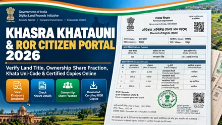
States use specific regional terms for ownership registers, plot numbers, maps, and mutations:
Scaled cadastral map showing plot boundaries, side lengths, and adjoining plot numbers (used in UP (Uttar Pradesh), Tamil Nadu, Gujarat, and Punjab).
Unique plot number assigned to an agricultural or residential parcel on the village map (such as Khesra in Bihar and Dag in West Bengal).
Record of Rights (ROR) register listing the landowner name, share, cultivator status, area, and bank loans (such as Rajasthan Jamabandi and Maharashtra 7/12).
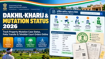
Revenue process that updates the new owner name in government records after a sale deed or inheritance (such as Intkal in Haryana and Pokkuvaravu in Kerala).
Direct answers to common questions about digital land records and cadastral plot maps in India:
Bhulekh (Record of Rights) is the text register (such as Khatauni, Jamabandi, 7/12 Extract, RTC, or Patta) that lists owner names, shares, area, and loans. Bhu Naksha (or FMB and Tippan) is the graphic map that shows the physical shape, boundary lengths, and neighboring plots of that parcel.
Standard online printouts serve personal informational checks. Download a Digitally Signed ROR and Map copy with a QR verification code (available on portals such as Aaple Abhilekh Maharashtra, MP Bhulekh, iORA Gujarat, Bhoomi Karnataka, and Tamil Nilam) or apply for a certified physical extract at the local Tehsil office for banking and legal filings.
The ROR confirms the registered owner name, clear title, and transferable land category. The Bhu Naksha confirms the exact plot size, road access, and physical boundaries on the ground.
Official state servers experience high concurrent traffic during peak business hours (10 AM to 5 PM). Security firewalls frequently invalidate sessions if a page stays idle. To prevent errors, access portals during off-peak morning hours (before 9 AM), use private browsing windows to clear cached tokens, or use the direct portal gateway links on BhulekhNaksha.org.
Computerized Khatauni records in states like UP, Uttarakhand, and MP list parcel areas in metric hectares (4 decimal places). You can convert these figures using our free dedicated Hectare to Bigha Converter: 1 hectare equals 10,000 square meters or 2.471 standard acres. In UP, 1 Pucca Bigha equals 0.2530 hectares (27,225 sq ft), while in West Bengal 1 Bigha equals 0.1338 hectares (14,400 sq ft).
BhulekhNaksha.org is an independent citizen public educational clearinghouse and directory. All instructional guides, area calculators, unit converters, and direct verified government routing links are 100% free with no registration fees or login requirements.