
Access the master All-India Bhulekh & Bhu Naksha Portal to inspect verified Record of Rights (Khatauni, Jamabandi, Satbara, Khatian) and download village Bhu Naksha plot maps across all 36 States and Union Territories.
चारों भुजाओं से खेत / प्लॉट का क्षेत्रफल निकालें (4-Side Plot Area Calculator)
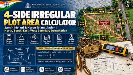
Most agricultural fields and residential plots have uneven boundaries. Patwaris and village Amins calculate the ground area using the average boundary method: Average Length multiplied by Average Width. Enter the North, South, East, and West boundary lengths in Feet, Meters, Kadis, Gathas, or Karams to calculate total plot area in Square Feet, Bighas, Gunthas, and Acres.
चारों कोनों से खेत का क्षेत्रफल निकालने का तरीका (How to Use 4-Side Calculator)
Measure the North, South, East, and West perimeter boundaries along ridges or wall lines.
Choose Feet, Meters, Surveyor Kadis (0.66 ft), Gatha (8.25 ft), or Karam (5.5 ft).
Select UP Pucca, Bihar, MP, Rajasthan, or Bengal Bigha to align with your Khatauni.
Review computed area in Square Feet, Square Meters, Gaj, Acres, Bighas, and Gunthas.
Calculate 4-Side Boundary Land Area (Jamin Mojani)
Enter the measured boundary lengths on all 4 sides and select your measurement unit:
अमीन और पटवारी द्वारा खेत नापने का मानक सूत्र (Surveyor Boundary Formula Explained)
In traditional revenue surveying across Uttar Pradesh, Bihar, Madhya Pradesh, Rajasthan, and Maharashtra, Amins and Talathis measure irregular quadrilateral plots using the Average Length and Width Method:
Average Width = (East Boundary + West Boundary) / 2
Total Land Area = Average Length × Average Width
This method provides an accurate approximation when opposite boundary sides are relatively parallel (within a 10% to 15% variation). For severely skewed trapezoidal plots or plots with extreme acute/obtuse angles, professional cadastral surveyors divide the quadrilateral into two triangles by measuring a fifth diagonal line (corner to corner), subsequently applying Heron's Formula:
Triangle Area = √[s × (s - a) × (s - b) × (s - c)]
Total Area = Triangle 1 Area + Triangle 2 Area
Traditional Survey Instruments & Conversion Factors
Historical Indian revenue maps and Field Measurement Books (FMB) record dimensions using traditional chains and surveying rods. Use this reference matrix to convert historical village measurements into modern feet and meters:
| Survey Instrument | Feet Equivalent | Metric (Meters) | Inches | Regional Application |
|---|---|---|---|---|
| 1 Gunter Chain (Jarib / जरीब) | 66.00 ft | 20.1168 m | 792 in | Standard All-India Cadastral Chain (100 Kadis) |
| 1 Kadi / Link (कड़ी) | 0.66 ft | 0.2012 m | 7.92 in | 1/100th of a Jarib; used on village Naksha sheets |
| 1 Revenue Gatha (गट्ठा / लट्ठा) | 8.25 ft | 2.5146 m | 99 in | Uttar Pradesh, Bihar, Rajasthan (5.5 Hath) |
| 1 Karam (करम) | 5.50 ft | 1.6764 m | 66 in | Punjab, Haryana, Himachal (3 Karams = 1 Kani) |
| 1 Gaj / Square Yard (गज) | 3.00 linear ft | 0.9144 m | 36 in | Residential plot frontages and municipal layouts |
| 1 Survey Hath / Cubit (हाथ) | 1.50 ft | 0.4572 m | 18 in | Eastern India (Bengal, Bihar, Odisha) rural plots |
Official Jamin Mojani Procedure: Demarcating Boundaries via State Land Records
When land disputes occur between adjacent agricultural plot owners, private measurements carry no evidentiary weight in a court of law. To obtain a legally binding boundary demarcation, landowners must apply for an official Jamin Mojani (Land Demarcation) through their respective state revenue portals:
- Maharashtra: Apply online on the Mahabhumi Mojani portal (mahabhumi.gov.in) with your 7/12 extract and 8A Khatedar certificate. Choose between Regular Mojani (60 days), Urgent Mojani (30 days), or Ultra-Urgent Mojani (15 days).
- Uttar Pradesh: File an application for Paimaish (पैमाइश) under Section 24 of the Uttar Pradesh Revenue Code, 2006 before the Sub-Divisional Magistrate (SDM) along with an updated Khatauni and court fee challan.
- Bihar: Submit a demarcation request through the Bihar Bhumi portal (biharbhumi.bihar.gov.in) to the Circle Officer (CO) with your computerized Jamabandi Register-II extract.
- West Bengal & Tripura (জমির মাপ ও সীমানা নির্ধারণ / Jomir Map Hisab): Submit a boundary demarcation petition before the Block Land and Land Reforms Officer (BL&LRO) under Rules 142 and 143 of the West Bengal Land and Land Reforms Manual, 1991 (read with Section 50 of the WBLR Act, 1955 and the Bengal Survey Act, 1875), accompanied by the latest computerized Khatian extract and certified Mouza cadastral plot map (Parcha). Note that Section 51A governs Record of Rights publication rather than physical boundary demarcation.
- Punjab & Haryana (ਨਿਸ਼ਾਨਦੇਹੀ / Nishan-Dehi): Apply for official boundary demarcation (Nishan-Dehi) under Section 101 of the Punjab Land Revenue Act, 1887 before the Tehsildar or Naib Tehsildar. The field Kanungo or Patwari conducts ground measurement using standard revenue survey chains (Gunter / Jarib).
- Gujarat (જમીન માપણી / Jamin Mapani): File an online application for agricultural land measurement and DILRMP boundary survey via AnyRoR and District Inspector of Land Records (DILR) portal.
- Madhya Pradesh: File for Seemankan (सीमांकन) through the MP Bhulekh RCMS portal (rcms.mp.gov.in) under Section 129 of the MP Land Revenue Code, 1959.
Related Land Measurement Tools & Calculators
Select any complementary calculator below to convert units, measure boundaries, or verify ownership records:
Universal Land Unit Converter
Convert between any two Indian land measurement units across states, including Bigha, Biswa, Katha, Dhur, Kanal, Guntha, Cent, Gaj, and Acres.
Land Valuation & Rate Converter
Calculate total land price and compare rates per Sq Ft, per Gaj, per Acre, and per Bigha to evaluate deals and stamp duty benchmarks.
Bigha to Sq Ft Calculator
Calculate state-specific Pucca and Kachha Bigha conversions across Uttar Pradesh, Bihar, MP, Rajasthan, and West Bengal.
Acre to Bigha Calculator
Convert standard 43,560 sq ft acres into regional Bighas for North, East, and Central Indian land records.
Hectare to Bigha Calculator
Convert 4-decimal metric hectares from official Khatauni records into legal Bighas and local sub-units.
Cent to Sq Ft Calculator
Convert 435.6 sq ft Cents and 1,089 sq ft Gunthas for Tamil Nadu, Kerala, Andhra, Telangana, and Karnataka deeds.
Gaj to Sq Ft Calculator
Convert Square Yards (Gaj) to Square Feet for municipal residential layouts and building approval plans.
Dismil to Sq Ft Calculator
Convert Dismil and Decimal units across Bihar, Jharkhand, Odisha, and West Bengal land records.
Stamp Duty & Registry Calculator
Estimate property registration charges and statutory female buyer concessions across key Indian states.
Family Khata Share Splitter
Divide joint ancestral land holdings among legal heirs and calculate individual acreage and square footage.
Bhu Naksha Map Scale Distance
Convert millimeter ruler measurements on 1:4000 village cadastral maps into exact ground distances.
Cross-Verify Ground Boundaries with State Portals
Compare measured ground boundaries with digitized parcel maps and Khatauni land registers on your state revenue portal:
Frequently Asked Questions on Plot Area Calculation & Jamin Mojani
1. How do you calculate the area of an irregular 4-sided plot without a 90-degree corner?
पटवारी औसत विधि का उपयोग करते हैं। औसत लंबाई को औसत चौड़ाई से गुणा करें। यदि कोनों का झुकाव अधिक है, तो विकर्ण मापें। इसके बाद दोनों भागों का क्षेत्रफल हीरोन के सूत्र से निकालें।
2. What is Jamin Mojani in Maharashtra and Gujarat?
जमीन मोजणी भूमि अभिलेख विभाग द्वारा किया जाने वाला आधिकारिक सीमांकन है। यह सीमा विवादों को विधिक रूप से सुलझाता है। 7/12 सातबारा और 8A के आधार पर सरकारी सर्वेक्षक पैमाइश करते हैं।
3. What is a Kadi (Chain Link) in land survey?
कड़ी मानक गुंटर जरीब (Jarib) का 1/100वां भाग होती है। 1 पूरी जरीब 66 फीट की होती है। इसलिए 1 कड़ी ठीक 0.66 फीट (7.92 इंच) के बराबर होती है।
4. What is a Gatha or Latha in UP and Bihar revenue measurement?
गट्ठा एक पारंपरिक बांस का पैमाना है। यह 5.5 हाथ अथवा ठीक 8.25 फीट (99 इंच) का होता है। 20 गट्ठा लंबा और 20 गट्ठा चौड़ा खेत 1 पक्का बीघा (27,225 वर्गफीट) होता है।
5. How many Gunthas make one Acre?
महाराष्ट्र, गुजरात और कर्नाटक में 1 गुंठा 1,089 वर्गफीट के बराबर होता है। ठीक 40 गुंठा मिलकर 1 एकड़ (43,560 वर्गफीट) बनाते हैं।